Notice: Function _load_textdomain_just_in_time was called incorrectly. Translation loading for the acf domain was triggered too early. This is usually an indicator for some code in the plugin or theme running too early. Translations should be loaded at the init action or later. Please see Debugging in WordPress for more information. (This message was added in version 6.7.0.) in /home2/tthrgsco/public_html/wp-includes/functions.php on line 6170
Deprecated: Function WP_Dependencies->add_data() was called with an argument that is deprecated since version 6.9.0! IE conditional comments are ignored by all supported browsers. in /home2/tthrgsco/public_html/wp-includes/functions.php on line 6170 Geospatial Services - T3 Global Strategies
Always accurate, always precise – actionable information you can rely on.
At T3 Global Strategies, we inherently understand that the geospatial products and services we deliver to our valued clients have a real and lasting impact on the world around us. Whether it’s building new highways, repairing and replacing our nation’s aging infrastructure, supporting our war fighters in far-way, hostile lands, or protecting the environment, our mapping products are at the center of it all.
How We Can Help
Analog and Digital Aerial Imagery Acquisition
Black and White, Color, Infrared
Airborne GPS/IMU
UAV, Helicopter and Fixed Wing Acquisition Platforms
Satellite Imagery Acquisition, Analysis, and Capture
Image Analysis
Softcopy Photogrammetric Extraction
True Photogrammetric Workflows for UAV Mapping
Aerial Triangulation
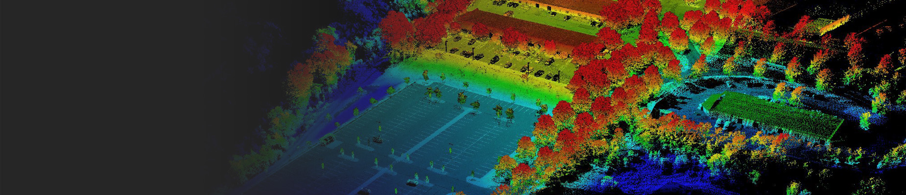
DTM/DEM/DSM and LiDAR
Topographic and Planimetric Mapping
Digital Orthophotography
Transportation Design Mapping (Low Altitude High Accuracy)
Floodplain and Storm Water Mapping
Municipal and Planning Mapping
GIS Base Mapping, Updating, and Design
Data Conversion Services (Utilities, Parcel Mapping and Energy)